Public Information Notice – Drone Flight for Mapping Purposes
Share:
The Department of Lands and Surveys informs the public that, for mapping purposes, an unmanned aerial vehicle – "Drone", will be operated in a rural area of the community of Polemi, Pafos.
The drone flights will take place from 26 January 2026 to 6 February 2026, between 09:00 and 14:00.
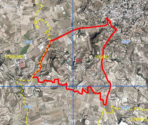
The flight area is located southwest of the community and is indicated in red on the attached map.
Please note that the data collected during the flights will consist of aerial photographs and will be used exclusively for internal purposes of the Department of Lands and Surveys. The data will not be disclosed to external parties.
The drone operations will be carried out in accordance with the regulations of the Civil Aviation Department, as well as legislation concerning the protection of personal data, ensuring legality and respect for citizens’ privacy at all times.